NASA Reveals Beirut Blast’s Tremendous Damage In New Satellite Imagery
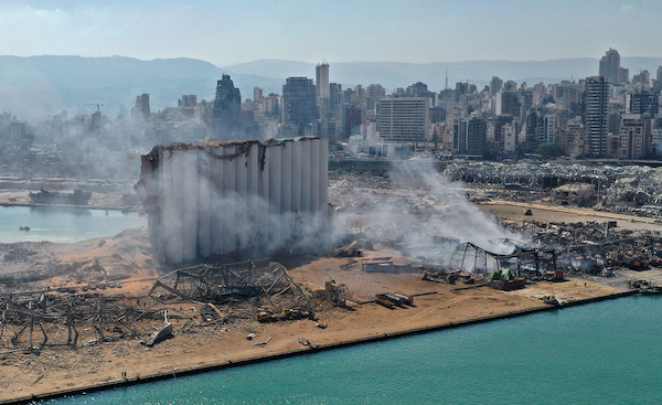
Image via Alex Gakos / Shutterstock.com
Parts of Beirut crumbled to a deadly mushroom-cloud blast on 4 August, causing shockwaves that wounded and killed many. Two explosions took place that day, but it was the second that left an upsetting mark on the capital, claiming at least 220 lives.
The blast was linked to some 2,750 tonnes of ammonium nitrate, tantamount to 1.2 kilotons of TNT, being stored unsafely in Beirut’s port for six years, making it one of the largest non-nuclear-related explosions to ever occur.
The repercussions were so extreme, monitoring systems have recorded the blast as equivalent to an earthquake with a magnitude between 3.3 to 4.5. NASA has now visualized the massive impact made by the catastrophe in a satellite map.
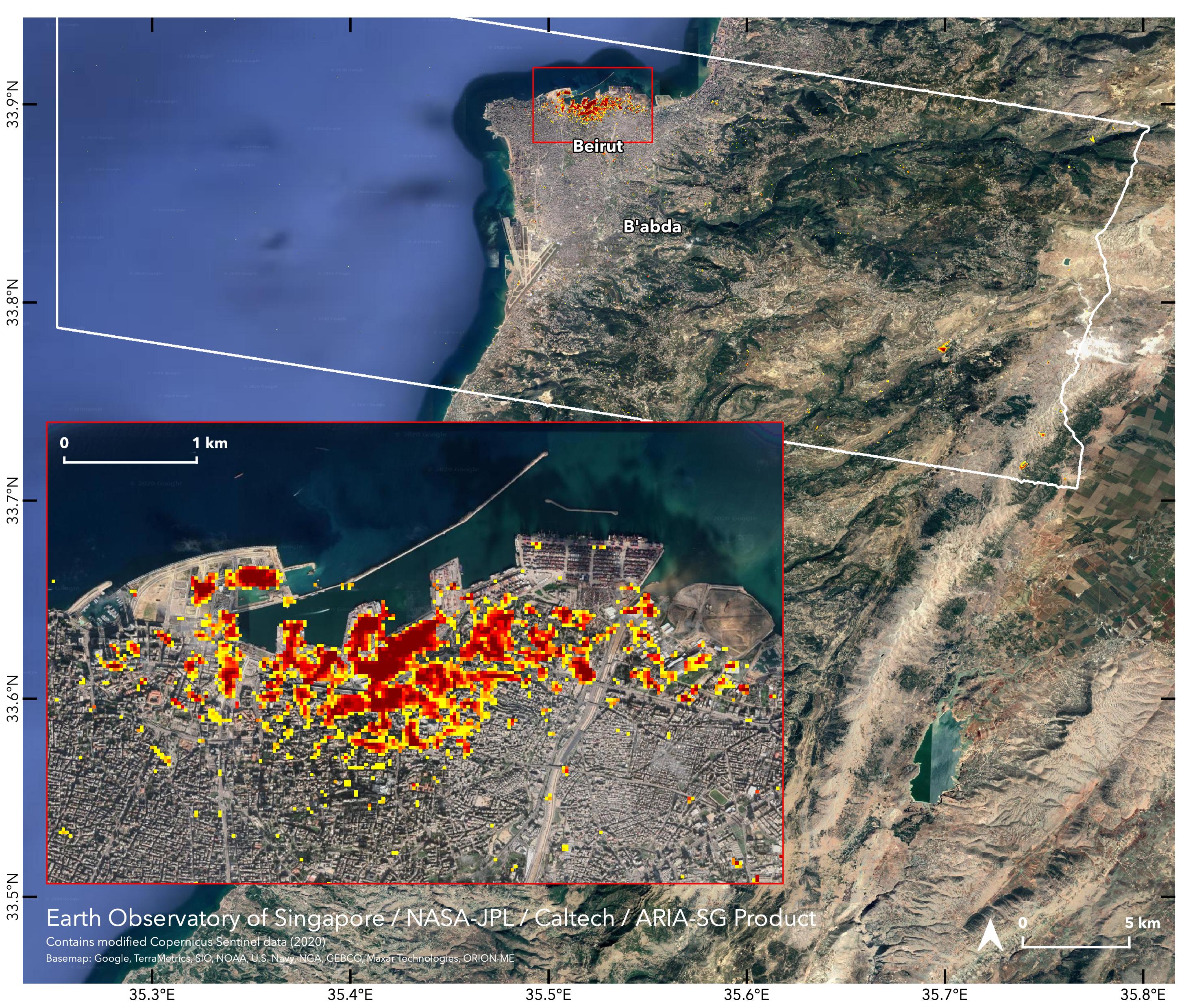
The visual, created by the space agency’s Advanced Rapid Imaging and Analysis (ARIA) team and the Earth Observatory of Singapore, is marred with large splotches of red along with some yellow. Each colored pixel represents 33 yards.
According to NASA, the yellow bands indicate “somewhat less damage.” Of course, the darker the red, the graver the impact.
Such maps are typically used to study ground changes before and after drastic events like earthquakes, but the effects of the blast were so significant, the same renders could be used here.
Click to view enlarged version
Click to view enlarged version. Image via NASA/JPL-Caltech/Earth Observatory of Singapore/ESA
[via Slashgear, images via various sources]
Also check out these recent news


